India’s highway network is entering a new phase. The National Highways Authority of India (NHAI) has announced that it will deploy AI Powered Dashcam Analytics Services (DAS) across around 40,000 km of the national highways network. The goal is clear: spot road defects earlier, improve maintenance quality, strengthen safety, and make highway operations more data-driven instead of complaint-driven.
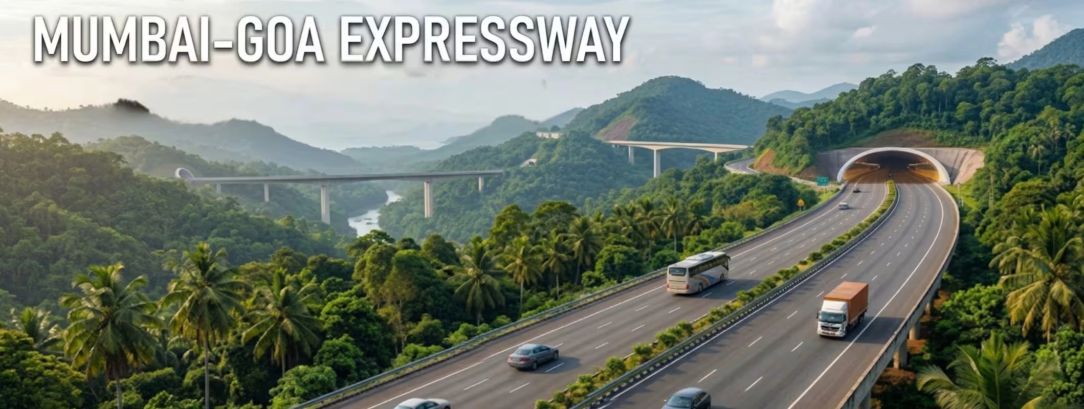
For real estate buyers, land investors, logistics players, and developers, this is more than a transport update. Better-monitored highways usually mean better-maintained corridors, stronger freight confidence, smoother access, and more reliable movement between cities, industrial zones, townships, and growth pockets. That does not mean every roadside plot becomes a goldmine. It means smarter infrastructure can improve the long-term investment case for the right locations. This is an inference based on the announced highway monitoring upgrade and how corridor-led infrastructure typically influences accessibility and land demand.
Key Takeaways
- NHAI will roll out AI-powered dashcam monitoring on about 40,000 km of national highways and expressways.
- The system will use dashboard cameras mounted on Route Patrol Vehicles (RPVs) to conduct weekly surveys on highway stretches.
- AI/ML models are being designed to identify more than 30 types of defects and anomalies, including potholes, severe cracking, damaged lane markings, non-functional streetlights, illegal parking, encroachments, and water stagnation.
- NHAI has also planned night-time surveys at least once a month to assess signages, markings, road studs, and lighting performance.
- For land and property investors, the bigger takeaway is this: smarter highways improve corridor confidence, and that can support demand for logistics land, commercial plots, roadside assets, and well-connected residential growth zones over time. This is an inference, not a guaranteed price promise.
What is the AI Dashcam rollout on Indian Highways?
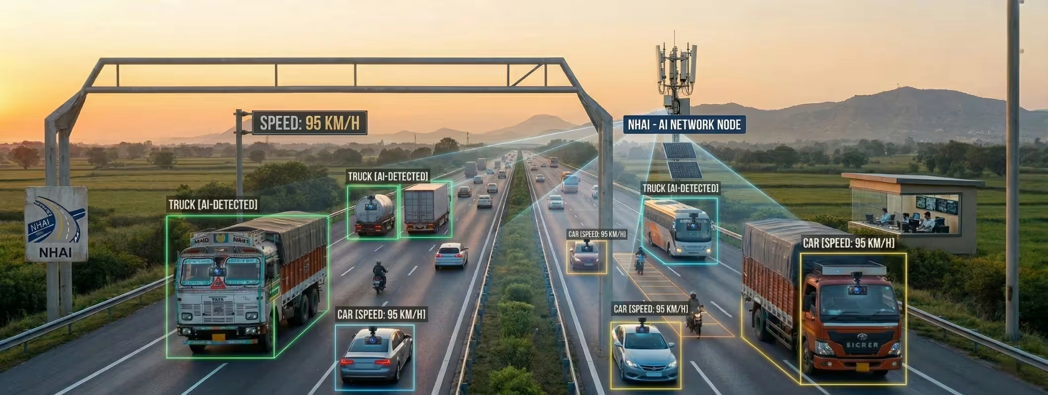
NHAI’s new system is not just a few cameras on a few roads. It is a large-scale highway operations upgrade. According to the official announcement by the Ministry of Road Transport & Highways on the 20th of March 2026, the NHAI will use AI Powered Dashcam Analytics Services for the national highway stretch of about 40,000 km. The system will utilize high-resolution images and videos captured by dashcams fixed on route patrol vehicles and subsequently process the same data with the help of AI and ML algorithms for the detection and reporting of defects.
This matters because highway maintenance in India often becomes reactive. A defect worsens, users complain, and repairs happen after the damage becomes visible or risky. The AI dashcam model is designed to push the system toward proactive monitoring, where defects get identified through scheduled surveys before they turn into bigger operational or safety problems.
What Exactly will these AI Dashcams detect?
The official release makes the use case quite broad. The new AI system will detect over 30 categories of defects and anomalies across pavement, road furniture, safety assets, and encroachment-related conditions. That includes potholes, rutting, severe cracks, faded lane markings, damaged crash barriers, non-functional streetlights, illegal median openings, unauthorized signboards, illegal parking, vegetation growth, missing drainage covers, and water stagnation.
It will also include night-time survey checks once a month for items like highway lighting, sign visibility, pavement markings, and road studs. That is important because many road-safety gaps do not show up clearly in daytime-only inspections.
Summary Table: What the AI Dashcam system is expected to improve
| Focus Area | What AI Dashcams will check | Why it matters |
| Pavement Condition | Potholes, rutting, cracking | Faster maintenance and safer travel |
| Lane Discipline Infrastructure | Faded lane markings, missing studs | Better visibility and safer driving |
| Roadside Safety Assets | Crash barriers, lighting, signboards | Lower risk from damaged safety systems |
| Encroachment Monitoring | Illegal parking, median openings, unauthorized boards | Cleaner, safer highway operations |
| Drainage and upkeep | Water stagnation, missing covers, vegetation growth | Better road quality and reduced deterioration |
| Night Audits | Signage, road studs, markings, lighting | Better night-time safety performance |
This table is based on the official NHAI/Ministry announcement.
Why India is moving in this direction
However, the road safety challenge in India remains a critical one. The data from the Ministry for the year 2022 reports that there were 4,61,312 road accidents and 1,68,491 fatalities on all roads. The data from the Ministry also reports that National Highways, which include expressways, accounted for 1,51,997 accidents and 61,038 fatalities in the year 2022.
The Ministry also reports that overspeeding alone accounted for 1,19,904 fatalities in the year 2022. This highlights the road safety challenge in India. While AI dashcams may not resolve all the causes for road accidents, they can help reduce the blind spots in highway maintenance.
So this move is not just a technology headline. It is part of a bigger push toward data-led highway operations, better maintenance visibility, and safer corridor management.
What this means for Connectivity and Economic Activity
When highways become better monitored, maintenance usually becomes more consistent. When maintenance becomes more consistent, corridor reliability improves. That matters for truck movement, travel time predictability, tourism routes, industrial access, warehousing, and regional business activity. This is an inference, but it is a practical one: smoother corridors improve how people and goods move, and that usually strengthens the appeal of locations that depend on highway access.
This is where the AI dashcam rollout becomes relevant for real estate. Investors who track highway corridor development, industrial growth zones, warehouse demand, roadside commercial opportunities, and land near major interchanges should pay attention. The value is not in the gadget. The value is in what better-maintained highways can do for corridor confidence.
How AI-monitored Highways can influence Land Investment
Let’s keep this practical.
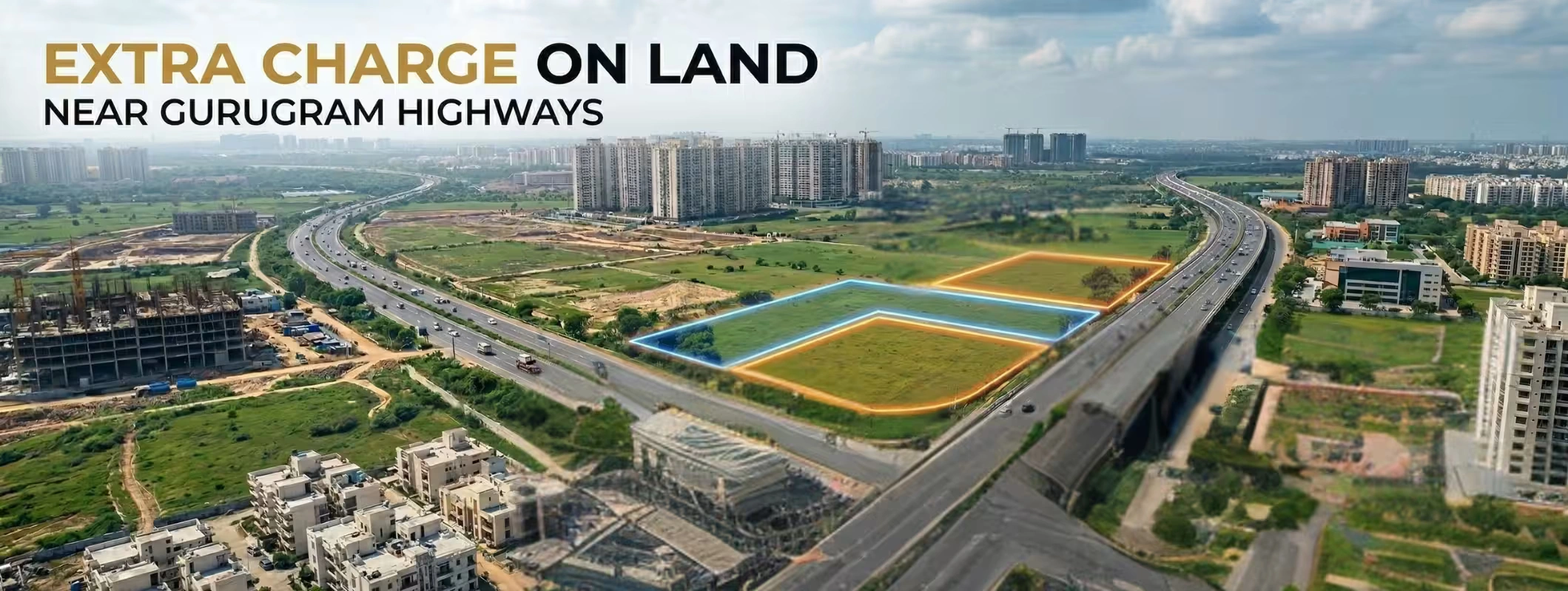
A better highway does not automatically make nearby land a smart investment. But a better-managed highway can improve the case for certain categories of land over time, especially where access, legal clarity, and end use already make sense. This is most relevant in areas such as:
- logistics and warehousing corridors
- plots near industrial belts and freight routes
- roadside retail and hospitality land
- land near toll roads, bypasses, interchanges, and expressway connectors
- residential growth pockets that depend on strong road access to nearby cities
This is an inference based on the announced highway monitoring upgrade and the way connectivity-driven markets typically behave. It should not be read as a blanket claim that every highway-side parcel will appreciate.
The real winners in a highway-led market are usually not random roadside plots. They are locations with usable access, clear title, future demand drivers, and real development logic.
What is 2Bigha?
2Bigha is a land marketplace platform in India that focuses on lands. According to its official website, it is a platform where users can search for lands anywhere, learn the latest prices of lands, find investment options, learn about the ownership of lands, and find out information regarding properties. On its website, users can also find verified lands, free land listings, digital Khasra maps, location information, and prices.
That positioning matters because land investment in India is rarely just about price. It is about location clarity, ownership confidence, access, and on-ground practicality. A platform that brings together land search, pricing context, map-led discovery, and locality insights can make the shortlisting process far more efficient.
How 2Bigha can help Investors in Highway-linked Locations
If you are trying to invest near a highway, expressway, bypass, growth corridor, or future logistics pocket, 2Bigha can help in a very practical way.
First, it helps you move beyond hearsay. Instead of relying only on broker language like “future growth area” or “highway ke paas plot,” you can start with location-led discovery, current price visibility, and map-based context. Second, where available, digital Khasra maps, verified land positioning, and locality insights can help you compare options more intelligently before you visit a site. Third, the platform’s locality insights and price trend visibility can help investors understand whether they are looking at a serious growth corridor or just a marketing pitch.
That does not replace legal due diligence. But it can improve your first-level filtering, which is where many bad land decisions begin.
Smart Checklist before Investing near a major Highway
Before buying land because a highway corridor is getting smarter, ask these questions:
| Checkpoint | Why it Matters |
| Is the title clear? | Good connectivity cannot fix a bad title |
| Is there proper legal access? | Highway visibility is useless without usable entry |
| What is the actual end use? | Residential, commercial, warehouse, farm, or hold strategy |
| Is the plot near a true demand node? | Interchanges, industrial belts, town expansions matter more |
| What does the local price trend show? | Helps avoid overpaying on pure hype |
| Are there map-level insights available? | Better understanding of location context and nearby drivers |
This is a general real-estate due diligence framework informed by the kinds of land discovery and locality features highlighted by 2Bigha.
Final Verdict
India’s decision to roll out AI dashcams across 40,000 km of highways is a meaningful infrastructure move. It shows that highway management is becoming more digital, more preventive, and more accountable. Weekly route patrol surveys, night-time checks, multi-zone monitoring, and AI-led dashboards are not cosmetic improvements. They are signals that the highway ecosystem is shifting toward smarter operations.
For real estate and land investors, the headline is not “AI cameras.” The headline is better corridor intelligence and stronger highway reliability. Over time, that can support better outcomes for the right highway-linked locations, especially where logistics, warehousing, commercial activity, and regional connectivity already have demand. That is an inference, but it is a commercially sensible one. And if you want to evaluate those opportunities with more clarity, 2Bigha can help by giving you a cleaner starting point: land search, price visibility, locality insights, map-based context, and verified-location discovery. In a market full of noise, that is useful.
FAQs - AI Dashcams
1. What are AI dashcams on Indian highways?
They are AI-powered dashboard camera systems that NHAI plans to mount on Route Patrol Vehicles to survey around 40,000 km of national highways, identify defects and anomalies, and support better maintenance and safety decisions.
2. How often will these highways be surveyed?
The official plan says route patrol vehicles will conduct weekly surveys on highway stretches, and there will also be night-time surveys at least once a month for evaluating signs, markings, studs, and lighting.
3. What kind of problems will the AI dashcam system detect?
The system is designed to detect over 30 types of defects and anomalies, including potholes, rutting, cracking, faded lane markings, damaged crash barriers, non-functional streetlights, illegal parking, encroachments, missing drainage covers, and water stagnation.
4. Will smarter highways improve property investment?
They can improve the investment case for the right locations by making access corridors more reliable and easier to assess, especially for logistics, roadside commercial, and growth-linked land. But they do not guarantee appreciation for every parcel. This is an inference based on infrastructure-led connectivity effects.
5. How can 2Bigha help in highway-side land investment?
2Bigha can help by offering land search, current land prices, locality insights, map-led discovery, and in many cases verified lands with digital Khasra maps and location context. That makes early-stage shortlisting more informed.